Showing posts with label travel. Show all posts

Monday, June 30, 2025

Minnesota's Mesabi Bike Trail - A 2025 Review

This past weekend, over two days with a night in Virginia, a friend and I road Minnesota's newest old trail - The Mesabi Trail across the northern Minnesota Iron Range.

The Messabi trail is unlike any other bike trail I've been on. It's beautiful with abundant wild flowers, a little bit insane in its ambition, and a credit to local champions and state and federal government programs that support low income rural America. It has been pieced together over 30 years from smaller local trails and extensive new trail construction in severe terrain and severe climate -- requiring painstaking negotiations with the lawyers of the wealthy investors (ex: Astors!) who purchased mineral rights in the 1920s and 1930s. Last year the MN Star Tribune described the trail.

We did the entire trail between Ely and Grand Rapids. It's marketed to be ridden in the other direction, but doing it in reverse shortened our drive home. We parked at the trailhead in Grand Rapids and took the excellent shuttle to Ely. There's a modest altitude drop from Ely to Grand Rapids, but traveling east to west as we did does run into the usual westerly winds. We were fortunate to have excellent weather.

Around the middle of the trail you cross the Laurentian Divide. To the west water flows to the Mississippi, to the east it flows to Hudson Bay (there's some complexity with the St Lawrence divide where water flows to Superior and the St Lawrence river but I didn't sort that out).

This is not one of those flat and straight rail trails we know and love. This trail has extraordinary bridges over wetland a mining waters but it often follows the terrain. Terrain that includes many punchy climbs and descents. I have never shifted my old touring bike triple chainring as much as I did during our trip!

The trail is beautiful and often lovely to ride, but unless you have an eBike there is real work involved.  We did roughly 70 miles each day with panniers and it felt more like a 90 mile road ride. Work is continuing on remaining segments. Severe weather washed out a segment near Giants Ridge, on a weekend we were able to duck under the barriers and (easily) ride through -- there was no obvious alternative! One unfinished section of the trail requires a few miles on no-shoulder but quiet road. There are gravel segments. Expect debris on the trail; the weather can be harsh at times.

If I were to do it again I'd either do it over 3-4 days or do it in segments and spend more time visiting the communities and admiring the scenery. On the other hand, given the time we had, two days was excellent.

The trail is both an adventure and an education. You can see many of the issues that are common across rural America -- people who established roots in places that no longer have an economic foundation. You pass through extensive open pit mines now being replaced by nature, sometimes on a narrow ridge between vast pits, sometimes between and over piles of removed rock. This is all more engaging and lovely than you might think.

Some lessons and tips from our experience.
  1. Order the paper trail map. I am surprised they don't provide a PDF version of this. If you don't order in advance they are available at trailheads.
  2. There are some long stretches, especially between Ely and Virginia, without water access. We needed a LOT of water. Two big water bottles were not enough for some stretches. I'd recommend an additional bottle.
  3. You need to use the Ride With GPS segments they provide. The trail map is not sufficient for navigation given limited signage and ongoing trail construction.
  4. You want a bike with a wide gear range and at least 32 mm tires for the gravel stretches.
  5. In several towns there is only the local pub to get water or food from. This area has been losing population, especially young people, for generations. Some towns have lost local groceries and local restaurants (other than the pub).
  6. I always had mobile coverage. That's good because this is a remote and rugged area and on several segments we saw very few people.
  7. Signage is limited. I don't know if vandals are removing them or if more sign work is planned for a later stage.
  8. Periodically check the satellite view to see what's outside the trail. One of the amazing things about this adventure is seeing nature reclaiming the old mines.
  9. Try to spend some money in the local communities. They need it. There is usually at least a pub, if you don't want a beer gets some fluids or snacks or a meal.
Paper trail map: You want this.

Trailhead arches display town name

Historical exhibits along trail

Town MN McKinley / Great War monument

Pontoon bridges are LOUD but spectacular wetland view

MN highest bridge east of Virginia - this is a pit mine

Virginia has steam vents for a system that once heated the town

Saywer is one of many state funded parks and monuments in Virginia

WPA fountain later restored. A testimony to government really

Trailside exhibit, one of last of underground mines

Downtown Virginia, much is gone but some new gems
All the brown is open pit mines - mostly invisible from the trail


Saturday, August 20, 2022

Phone and data services for travelers to Europe

Our daughter is doing a semester abroad in Florence Italy so I've been looking into voice, SMS and data services. In particular the transition from physical SIM to eSIM has given us new options and new complexity. 

I found these sites useful:
Some key findings:
  • The use of SMS as 2FA means she needs access to her US SMS number
  • Although AT&T charges $10 a day for data access it's capped at 10 days of use a month. So max of $100 a month. As soon as you data roam the charge is activated for one day (I think local midnight?)
  • For $15/month she can call US numbers toll-free and send and receive SMS without a fee.
  • The Savvy Backpacker overstates how established eSIMs are in Europe -- especially if you want a local number. I think physical nano-SIMs are still the default and are more economical
  • European eSIMs are often data only, there's no local number. I wanted a local number she could use though we may find that's not necessary.
  • eSIM prepaid plans vary in when the clock starts running and when service expires ("credit validity"). Expiration is in the range of 2 to 4 weeks from either purchase or first use or activation.
  • Supposedly any EU mobile plans works without roaming fees.
  • Foreigners buy SIMs in Italy probably need to jump through paperwork with hidden feeds for "antiterrorism" measures -- and because this is Italy.
We decided to:
  • Pay the AT&T international plan fee so she can do SMS and phone on her US SIM.
  • Accept that at first she may roam on her AT&T SIM for $10/day ($100/month) until we sort out options
  • Switch her iPhone to use AT&T eSIM even though that will cause AT&T to charge us an "activation fee" of $30 (I hate that scam). That frees up a slot for a local SIM card. (We found that the on-iPhone SIM-to-eSIM conversion does not trigger an AT&T activation fee!)
  • Plan on buying a physical SIM in Italy, compare options to Lebara.
Update 9/22/2022

Some things we learned after going through the process ...
  1. We switched her US AT&T SIM to eSIM so we freed up her physical SIM slot.
  2. On arrival she used her AT&T SIM until she had a local SIM ($10/day of use, max $100/mo)
  3. In Italy her host organization recommended a local vendor and SIM at a reasonable monthly rate. They streamlined the paperwork.
  4. With iPhone dual SIM her phone is set to:
    1. AT&T eSIM: no roaming, active so can receive texts and calls (no fee to receive)
    2. Local Italian physical SIM: no roaming but provides local data services. Can send and receive calls and texts.
For my part I'm traveling to Florence in a few days. I'm planning to just pay AT&T $100 and use their roaming service. (I tried to be sneaky and sign up for T-Mobile's Network Pass, but of course that doesn't qualify for roaming services.)

A reader, François H., provided some additional useful information for longer term visits (like my daughter's):

① Expect paperwork in any EU country to open a phone line. It is normal procedure to be asked for a passport and proof of address in the form of a lease agreement, landline bill or some other antiquated piece of paper (gas bill, tax return…). I share your feelings on how intrusive and pointless this is, but this is, sadly, a universal hurdle. At a pinch, a handwritten sworn statement from a host often works, alongside a copy of their own ID.

② Beware of eSIMs: they work well but many companies force users to start with a physical SIM before switching to an eSIM, especially when replacing the SIM after the loss or theft of the original phone, supposedly “for security.” This makes your decision to leave the physical slot open in Europe all the more important, as it may be impossible to activate or renew an eSIM directly. (The biggest trap is that it is usually possible to open a new line as an eSIM, but not to transfer or restore it without going physical for “verification” purposes.)

③ Beware of EU roaming: yes, it is possible to roam in the EU without incurring additional charges, thanks to one of the EU’s few straightforwardly positive laws. However, there is a so-called fairness clause attached: travellers must still use more data or minutes per month in the plan’s home country than they do in other EU countries. Failing this, the phone company will be allowed to charge extra. This is to prevent consumers in expensive EU countries from purchasing cell plans in cheaper countries and using them at home full time. In other words, EU-wide roaming works great when travelling within the EU but cannot be relied on to source a cheaper or better plan for someone who plans to remain in another country. (It is also not uncommon for schools and various government offices to require local phone numbers, making the use of a foreign number rather risky.)

Wednesday, October 27, 2021

Inline Skating San Francisco -- from 1997!

I wrote this in 1997 and found it in my old pre-blog Web 1.0 archives. I decided to republish it here because, you know, I could. Some of it may even be relevant today.

Before blogs we did this kind of thing in wysiwyg tools (FrontPage 97 for this piece) and then FTPd to a web server. 

The original page is still on the web but it is not known to Google. Astonishingly it's in the Wayback Machine.

Monday, September 09, 2019

Bicycling North Dakota's Maah Daah Hey trail with Western Spirit

Last week I bicycled most of North Dakota’s Maah Daah Hey trail. The New York Times’ John O'Connor described it in 2018 (emphases mine) ...

… One moment I was bouncing along, knee-deep in sagebrush, mind reeling from all the natural beauty zipping by, and the next I’d caught a wheel on a rock and gone sailing into that familiar somersault: butt rising from the saddle, shoulders twisting violently, hips lurching up-and-over, heels actually clicking midair, sunglasses and water bottle and half-eaten Clif Bar hurtling into the trees, the ground closing in...

… it had been my idea to cycle the Maah Daah Hey Trail, the longest and arguably most grueling single-track mountain biking route in the United States...

… I was an unlikely candidate for the trip: I had never ridden a mountain bike before, or even camped much….

I read that introduction before the ride and I scoffed. How would O'Connor  know about going OTB (over the bars) if he’d never ridden a mountain bike? And wasn’t riding a “grueling" single-track absurd for someone with no prior experience?

So of course I went OTB on my first day on the trail. Damn water break bumps, I really didn’t know how to ride them at speed. I learned.

Anyway, after doing that trail outfitter glamping style I gotta admit that while O'Connor doesn’t have the best judgment, he is pretty tough. 

I could write a lot about the experience. The crew I rode with were each worth a story of their own! Alas, I don’t have the time or talent to do that justice. Instead, since I’ll share some things I wish I’d know before the trip. 

Western Spirit

There are two full service outfitters that supply guides, food and water, and gear transportation. I used Western Spirit, but I’m told the competition is also excellent. Dakota Cyclery will do gear transportation but no longer does guiding, I think it works with both outfitters.

This was my first experience with an adventure cycling outfitter. Some things I didn’t know:

  • Our guides were superb. They were also extreme athletes, so they have different attitudes towards “steep” and “exposure” then civilians.
  • The foot is amazing — quality, quantity, variety. Our guides really knew how to cook. Probably 4000-5000 calories a day plus gel packs, snacks, bars, etc. I neither gained nor lost weight and I ate a lot.
  • I drank 4-5 Liters on a hot day and I was still behind. Have a big hydration pack and make sure you fill it. The guides expect you to know to do that.
  • Guides supply gel packs and sunscreen, but to be safe you should carry your own as well.
  • Bring your own derailleur hanger. They don’t have those for every bike. Also a replacement chain link in case the join link brakes.
  • You are expected to tip. I’m not sure how much, but on a $1200 tour 15% is about $200. The ideal is one rider collects funds and presents them as a single gift. Have cash with you.
  • One guide rides sweep and one rides truck. Unless you’re dead last you may be well ahead of the guide. Some days I had a lot of time alone on the trail.
  • You can bring a four person / family tent, it doesn’t have to be a backpacking tent.
  • We didn’t do the whole trail. We started at a camp site about 16 miles south of the Northern CCC terminus, so south of China Wall (never saw it). They did a Friday ride on a different but really excellent trail that was basically a sub for that segment.
  • My companions were older than I’d expected and they were all more skillful than me. Of our group of 7 four were over 60 including our best descender. I think mountain bikers do the Maah Daah Hey when they’ve done everything else many times and are looking for something different.

Maah Daah Hey notes

  • The trail doesn’t seem technical compared to Sedona or Moab, but it has its own challenges. There are a lot of steep climbs with marginal traction — only the super-strong and skilled can nail every one. There is exposure on loose surface tight off-camber downhill hairpin turns. There are deep ruts that suddenly appear along the trail that you don’t want to hit at speed. The working trail itself is effectively narrow, a tire worn 8” dirt path with grass alongside. You need a smooth pedal stroke and good control to avoid hitting the grass ledge along the trail.
  • Unless you’re really good you can’t look around and ride, you need to stop to take in the scenery.
  • Everyone in my group had a modern XC/Trail bike — dropper post, 1x12, tubeless, full suspension, 29” wheels, slack geometry. Everyone … except me. My bike was out of the mists of time. If you don’t have "that bike" I recommend renting from your outfitter or Dakota Cyclery.
  • Flats or Clips? Most do Clips, I did Flats because I was willing to sacrifice some climbing power for faster exits. Clips make for smoother pedaling though, and make it easier to stay on the narrow trails.
  • If it rains you are screwed. The trail has been getting more rain the past few years … which makes the landscape surprisingly green but the trail unrideable. The Bentonite soil turns to cement, only a very strong rider with lots of frame clearance can get anywhere. Rain is the achilles heel of the Maah Daah Hey. We were lucky to have only one rainy day and 2-3 h of hike-a-bike. If rain persists outfitters bail to hikes and gravel rides. It’s a risk.
  • In September there were almost no bugs at our campsites!
  • You don’t see bison. This is ranch land, bison are not welcome. You see lots of very healthy and powerful looking cows and maybe some gazelle. We heard lots of coyotes but didn’t see any.
  • We met 2-3 people total on the MDH trail over 4 days. There were hunters at the campsites; they campsites are all reachable by road.
  • We crossed the Little Missouri twice carrying our bikes, there are multiple stream crossings. Don’t try to ride across, you’ll get mud everywhere.
  • You can get lost. The trail is well marked until it isn’t. It’s good to have guides. There are one or two spots that could kill someone moving fast in the wrong direction.
  • The landscape is more diverse than I’d expected. Badlands, grasslands, even some thin forest. It really is beautiful to ride across, not least through the wide grasslands.
  • I bought inexpensive sun sleeves and a weird geeky neck/ear sun cover that fit under my bike helmet. They were great.

More updates and revisions to some … if time allows ...

Monday, October 10, 2016

Cumberland Wisconsin is peculiar

On a meandering drive home from a northern Wisconsin bike race I passed through the town of Cumberland Wisconsin.

It’s in the middle of nowhere.

Screen Shot 2016 10 10 at 10 33 20 AM

It’s a pretty town. Too pretty. Like something out of a Stepford Town movie. What’s going on with Cumberland?

The wikipedia article is what a small town (2,300 people) article should be — it reads as though it were put together by a local school. There are a few items that stood out for me…

… 34.2% German, 24.7% Norwegian, 14.1% Italian, 10.3% Irish, 9.6% Swedish and 8.2% English …

… 35.1% of all households were made up of individuals …

… median income for a household in the city was $32,661, and the median income for a family was $41,612… 

They have a fancy Carnegie library. From the history …

 … After the railroad began to operate, settlers quickly arrived in the area and by 1884 there were 24 saloons located in the area … In February 1893, the state board of health sent a representative to set up a quarantine on the Italian settlement due to unsanitary conditions … In April [1895], telephone lines were also erected in the city limits…  On March 15, 1905 a $10,000 donation from Andrew Carnegie established a Carnegie Library in Cumberland …

How common were telephone lines in 1895? Why did they gets such a big Carnegie donation in 1905? Does all this have anything to do with the what lives at the bottom on the lake?

Monday, October 19, 2015

London

This year has been a different year. By circumstance not of my choosing, but not displeasing, I’ve more personal time than usual, but also, for a time, income. So each of our children got to pick a trip with Dad. My 13yo daughter, #3, chose London. 

I was thinking Chicago, or perhaps Manhattan, but she was being mischievous, so London it was. We spent six days touring the city. By the city I don’t mean only “Zone 1”, the city of Old London and West London, but all the way out to Zone 3 and 4 — we stayed in an Airbnb in Mitcham, an utterly unremarkable bit of the megacity sprawl about 25 minutes of overground south of Blackfriars station. For my own reason I’m going to make a few notes about our experience, but these must be hasty notes. Life spins on. So they will be roughly sectioned, and made of bullets rather than paragraphs. There are two parts - impressions of the city and practicalities of modern travel.

Impressions of the City (mostly my surprises)

Emily and I spent a day or two in London about 30 years ago. That’s almost halfway to post-war London, though we didn’t think of it that way. I didn’t know much about the city, we basically visited a museum or two.

This time I was better prepared. I purchased a Great Courses (Teaching Company) audiobook course on the the History of London. It was superb; the device of replaying walks through London of various times guided our travel. My favorite travel book was Fromer’s London Free and Dirt Cheap, and my favorite map was an old map once published by London Transport, the “London Map”. It's now a secret but still available from Visit Britain. I had difficulty finding a good map of London, the era of paper maps is passing quickly. I think it is also true that the scope of London is a challenge to map makers.

It took me some time to grasp the scope of London. Guide books and most descriptions fail here. London is a mega-sprawl like Atlanta, but unlike Atlanta it has a central Core. The Core, better known as Zone 1, is morphing from a place where people live and work and visit to a place where people work and visit — but do not live. Zone 1 is a kind of urban singularity — bending light and threatening to fall out of the scope of normal human interaction. The expenses of operating there are pushing food and recreating prices out of the scope of most humans, but it still defies gravity. Last year was another record breaking visitor year. Older museums remain free — but that accessibility seems to be at risk. Newer museums, and even some older ones like the Monument (to the Great Fire) charge high fees. On the other hand perhaps part of London’s modern attraction is the opportunity to watch the wealthy at play, a kind of zoo for bankers and billionaires.

London has some attractive and charming areas — we visited many of those. I think it has less than many European cities though, probably less than Leeds. It is a city of power and commerce, thrusting and urgent. The 19th century swept away much of old London, rebuilding in a confusing array of faux-oldness that recalls the changes of modern Beijing. WW II destroyed a lot, and rebuilding was rough. A bit, as is often noted, like the rapid reconstruction after the Great Fire. For a city with a lot of history London has some of the ahistoric callousness of Los Angeles.

Happily, London is also a city of vanity and show. We only walked through the theater district, but we did visit most of the “great” museums. No irony in those quotes, they are everything they claim to be. (Note to British Museum — please get some local banker to cough up 50 million quid so you can affix an artist’s picture of what the artifacts would have looked like with paint and context. Also, London’s Chinatown rarely gets a mention, but it has great food in the midst of the theaters.)

I’d read that London real estate was emptying out — that empty rooms are traded by billionaire speculators who want a bolt hole or a spot to stay when doing business. That felt true, but also lazy. This is true of Zone 1, which is not so large, and, I suppose, bits of Zone 2. There’s a lot of London where billionaires don’t go. We stayed in one of those parts, and traveled far East to visit the Dr Who Shop in another. (Our itinerary was largely set by my daughter, with a focus on Dr Who and Harry Potter and a bit of Sherlock. And shops — especially museum shops.)

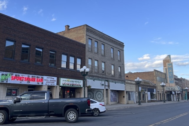
This wasn’t our original plan, but I wanted to stay in a quieter place where we could visit grocery stores and save money and sanity by making our own breakfast and dinner. That meant Airbnb, and thanks to a bit of a mixup of mine we ended up in an utterly generic and relatively distant part of the London of Ordinary People. A place of vast sprawls of narrow homes and many languages — our particular area seemed to specialize in blue collar English, Poles and other Slavs, and 3rd generation south Asian. A similar region out East was more Islamic. Learning our residential neighborhood was one of the more remarkable parts of the visit. I think by British standards these are somewhat scary neighborhoods, but we are urban Americans. They are benign by our standards.

Londoners smoke. This really surprised me. Americans don’t smoke, particularly after teenage years. I felt like I’d taken a Tardis back to my childhood — adults of all ages smoking in the streets, but at least not indoors. My daughter was shocked. I wondered if part of this came from migration from cultures were smoking is widely accepted, but I feel it’s also a part of local culture — much as cocaine use was part of 1970s America. The urban air quality is also poor by our standards. 

Other surprises — how car-centric London is. Capacity pricing works, so the cars do flow, but they flow at full capacity all the time. Which is, really, a triumph of the market. A market triumph with an unintended consequence; a city full of wealthy drivers who pay heavily to drive is a city that will be utterly dominated by the car. I’d gotten a hint of this from reading a London Bicycling blog, but it was still a surprise given London’s reputation as a walking city. We walked 8-12 miles every day, and the streets are very crowded with walkers even in the off-season, but all of us pedestrians are second class. There are no crosswalk laws (de jure or de facto) — one crosses if a car allows or between gaps in cars. The city is not friendly to the weak — walkers need to move quickly and be alert.

The transit system does it’s part to screen out the unfit — “mind the gap” is a serious warning. Getting on and off the tube is similar to boarding a bus or train — only a few places can handle a wheelchair. Many tube stations work on escalators or stairs alone. There is nothing like the American accommodations for disability, even the much weaker Canadian accommodations.

Despite all of this, there are many cyclists. They are, however, serious commuter cyclists. With the exception of a few suicidal tourists on Santander cycles they are fast and fit cyclists wearing high visibility clothing and moving, when possible, in coordinated packs. There is no room to pass, bicycle commuting in London is a blood sport. Aside from a dull path through Hyde Park we saw no protected bicycle lanes — nothing like our home town of St Paul, much less Minneapolis, much much less Munich. They ride, I presume, because there are many transit advantages to London bike commuting, and because traffic often moves at the speed of a fast and fit cyclist.

London is much less safety conscious than an American city (perhaps our safety fetish is a response to our violent culture?). We are used to doors that open outwards for fire exit, in London doors open in and out. Some tube stations would be death traps in an emergency. The cars move slowly but implacably. The infrastructure is a mix of expensive deluxe (Heathrow Express from Paddington is a touch of wealth) and less-expensive-but-still-not-affordable rickety. Google Maps was brilliant at rerouting around broken underground links — the London transit network needs its switching redundancy.

Incidentally, some of the core attractions in London are effectively unavailable to normal people. My daughter wanted to do High Tea at the Ritz — but those tickets appear to be entirely purchased 6 months out, presumably by hotels. Same thing with theater tickets — I think if you want do theater you need to queue at Leicester square for the last minute openings. We did our High Tea at Fortnum and Mason instead — which worked well. 

Practical and Geeky Things I learned (in bullet points, because geeky)

  • Google Maps for iOS and web are magical. I knew that, but in London, particular given our remote Airbnb residence, we depended very much on Google maps and ThamesLink.app. From ThamesLink we reviewed “overground” trains from Tooting station to Blackfriars, then used Google to evaluate transit options at various times or on the fly. When creating walking tours we could add point-to-point direction and have Google pick interesting routing and show us geographically related transit options. It’s not quite perfect — I’d like to be able to mix transit and foot connections when plotting routes — but it is a kind of magic only the old can appreciate.
    Screen Shot 2015 10 14 at 6 22 16 PM 
  • I thought we’d put in a SIM card and connect to London’s GSM network. Our hosts picked up a set of SIM cards for us to try, but I discovered that we couldn’t activate online them with an American credit card. We’d have had to visit something like a Carphone Warehouse and buy a GB there, or perhaps pick up a card at Heathrow. Instead we used AT&T’s Passport option. At roughly 0.25/mb it’s not cheap, but that’s nothing compared to London transit costs — and we didn’t feel like spending an hour getting kitted out. I locked down cellular use and turned on Data Roaming only when needed - usually for a Google Maps consult. The museums often have quite good WiFi, in the end our data costs were modest. London has some sort of citywide WiFi but it never worked for us, it’s just a source of interference. I found i was getting low speed 3G data until I allowed a Carrier Profile update; after that I had LTE. (There’s more complexity with GSM swaps than most of us imagine. I see why smart people don’t swap GSM cards but instead purchase a mobile hotspot device and swap cards in that.)
  • Google Drive kind of sucks if you don’t have a constant data connection. It’s very awkward to force documents to be locally stored on an iPhone. I’m migrating to Dropbox for a variety of reasons, but for this trip I’d plot out our walking plans on my laptop using our Airbnb host’s excellent data connection, then print with maps to PDF in Google Drive, then on my iPhone I’d migrate the PDF to iBooks. Awkward, but it worked.
  • I mentioned listening to the Great Course on London history (hint: much cheaper to buy via iTunes from Audible than from Teaching Company). I wish I’d created a short reference outline of English history in Simplenote that I could hang things off of. A list of key London events, related rulers, etc.
  • We traveled with my 2015 MacBook Air (non-Retina and I love it), two iPhones and one iPad. Instead of hassling with lots of chargers I brought a 5 device charger (Anker makes good ones), a single UK plug adapter, and a simple 3 outlet extension cord. Worked perfectly. (Of course voltage adapters are no longer needed, with a few exceptions modern devices switch between 110/200 automatically.)
  • I’ve had my issues in the past with Airbnb, but this time it seems to have worked out well. Airbnb encourages use of their system for communication between host and guest, but I wasn’t getting much in the way of responses that way. Once I started using direct SMS/iMessage instead the problem resolved. Young folk don’t do email.
  • London is a city of Apps. Apps for transit, Apps for museums, etc. Pick up a few. I wish I’d tried History Pin.app or Localscope.app (or the equivalent) but I more or less forgot I had them.